
Gràcia
Gràcia is five neighbourhoods, and three of them used to belong to Horta
People say Gràcia and mean about a third of it. The district on the map has five neighbourhoods, only two of which were ever part of the town, and the confusion is not the visitor's fault — the city's own pages cannot agree on the numbers either.
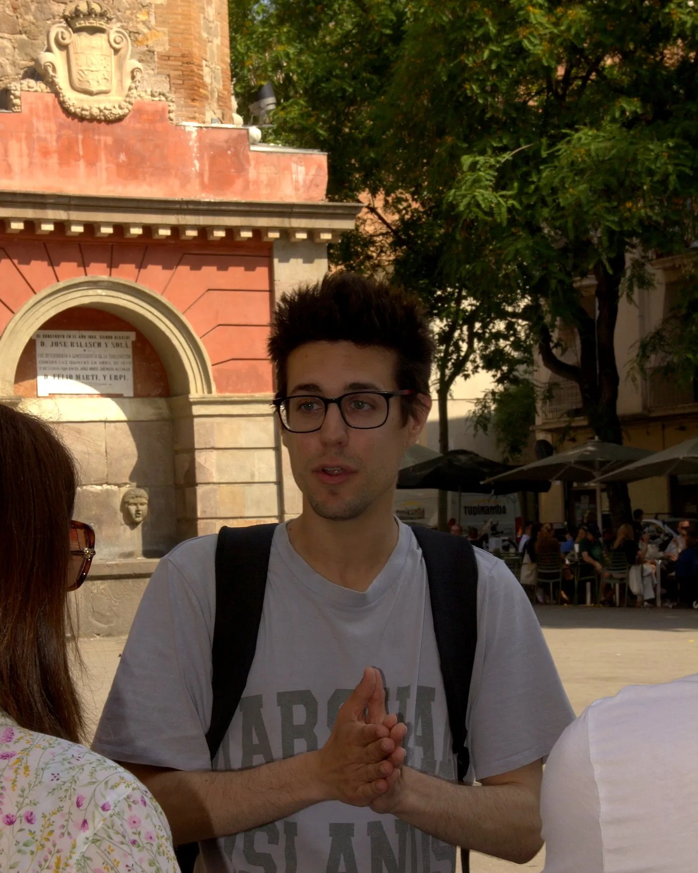
Somebody tells you they are staying in Gràcia. You picture short streets, small squares, washing on the balconies, a bar with three tables outside.
There is a one-in-three chance they are staying on a hillside twenty minutes uphill from any of that, in a neighbourhood that belonged to a different town until the nineteen-eighties.
This is not pedantry. It changes where you sleep, how long your walk is and how steep it is, and it explains why half the advice you read about “Gràcia” contradicts the other half. The two things are called the same name and they are not the same place.
The list, from the city’s own register
Barcelona publishes its administrative units as open data, and under district 06 there are five entries. In the official spelling, definite articles and all:
| Barri | Residents (2021) | Area | Density |
|---|---|---|---|
| la Vila de Gràcia | 49,492 | 132.1 ha | 375 /ha |
| el Camp d’en Grassot i Gràcia Nova | 34,932 | 65.1 ha | 537 /ha |
| Vallcarca i els Penitents | 16,142 | 125.1 ha | 129 /ha |
| la Salut | 13,282 | 64.8 ha | 205 /ha |
| el Coll | 7,590 | 35.3 ha | 215 /ha |
Look at the top two rows and the bottom three. Two-thirds of the district’s people live on less than half its ground; the rest is spread thin up a hill. That is the whole geography in one table, and it is why a walk that reads as ten minutes on a map takes half an hour and leaves you out of breath.
A note on the density column, since it is the sort of thing that gets misquoted. The city publishes two densities for every neighbourhood: this one, which divides people by the whole area, and a net density, which divides them by residential land only and comes out roughly twice as high. La Vila de Gràcia’s net figure is 589 per hectare. Neither is wrong; they answer different questions. We are using the gross figure throughout because it is the one you can compare against a map.
And now the part where the city disagrees with itself
The district of Gràcia has its own website, with a page listing its five neighbourhoods, and that page gives different numbers.
It says the district has 120,907 residents on 418.60 hectares. The open data adds up to 121,438 on 422.4. It says Vallcarca i els Penitents covers 120.90 hectares; the open data says 125.1. That is more than four hectares of hillside that exists in one municipal publication and not in the other.
We cannot reconcile them and we are not going to pretend we can, because the district page carries no reference year at all — no date on the figures, nothing to say which census they come from. Its population total does not match any year of the municipal register between 2019 and 2026, so it is not simply an older snapshot of the same series.
So: the numbers above are the ones from the open data, dated 2021, and if you find different ones on the district’s own page, you now know why.
Three of these five were never Gràcia
Here is the thing almost nobody mentions.
The district was created in 1984. The town was annexed in 1897. They are different shapes, and the encyclopedia says so in a single clause that does more work than anything else on this page:
In 1984 the district of Gràcia was created, which to most of the old neighbourhood added Vallcarca, el Coll and els Penitents, which belonged to Horta.
Belonged to Horta. Not to Gràcia. Horta was its own municipality on the other side of the hill, and Vallcarca was one of the districts it was divided into — with 1,779 inhabitants in 1905, a third of Horta’s entire population. The city’s own street register confirms it from the other direction: the entry for Avinguda de Vallcarca states flatly that it formed part of the municipal district of Horta and of the parish of Sant Genís dels Agudells.
And the trade went both ways. The south-western corner of the real old Gràcia — everything beyond Via Augusta — was handed to Sarrià-Sant Gervasi and to the Eixample. There are streets that were unarguably in the town of Gràcia in 1896 and are in two other districts today.
If you want the town itself, and why it behaved the way it did, that is why Gràcia was its own town; the afternoon it went furthest is the revolt of the quintes.
A small hole in the record, left as we found it
The register’s entry for Vallcarca sets out to tell you exactly when it changed districts, and then stops:
it only came to depend on the district of Gràcia from the year …
That is the published text. The sentence ends in an ellipsis with no year in it. We could fill the gap from somewhere else and attribute it to the register; we are not going to. The encyclopedia gives 1984 for the creation of the district, which is a different statement from a transfer date for Vallcarca specifically.
While we are counting: the encyclopedia says Vallcarca was one of four districts of Horta, and, two entries away, that els Penitents was one of five. Same publisher, same century, two numbers.
What each of them actually is
la Vila de Gràcia is the town. Twenty-one named squares against three named passatges — and the other twenty-seven passatges of the district are up the hill, which is a good short proof of everything on this page. No sightlines, uphill, and everything that gets photographed. This is the one people mean, and it is the only one of the five we would send anybody to walk around without a reason. What is in it, in an order that does not double back, is what to see in Gràcia; why it is shaped like that is the street plan.
el Camp d’en Grassot i Gràcia Nova is the densest neighbourhood in the district and it is not a town at all: it is Eixample grid, chamfered corners and long straight streets, laid out later and separately. The district’s own history page says as much — a more recent sector and, for that reason, autonomous from the Vila. It is where La Sedeta stands, the silk works that became a school and a civic centre, and where most of the district’s covered passageways turn out to be.
Vallcarca i els Penitents is the low-density one: 129 people per hectare against the Vila’s 375, on almost the same amount of ground. The register describes it growing at the end of the nineteenth century as a summer neighbourhood for Barcelona’s artisan class, keeping its structure of villas and small workshops until the nineteen-fifties, when they started building upwards. The name, it says, is a Latin-Arabic hybrid meaning noisy valley — a stream, in other words, like most of the names down the hill.
The Penitents half has the best origin story in the district. Six hermits settled there around 1860 under a preacher called Pare Palau, who dug caves into the hillside for solitary penance and, around 1868, was bringing out a publication called The Hermit. The poet Jacint Verdaguer bought the estate in 1892 and lived in it. The council of Horta demolished the convent in 1895.
la Salut is named after a chapel. It opened for worship in 1864, in a house, and the neighbourhood was built around it between 1866 and 1870. The street kept the plain name de la Salut until 1949. Most of what a visitor knows of la Salut is not the chapel.
el Coll is the smallest and the highest, thirty-five hectares on the far side of the ridge, built up in the last third of the nineteenth century with small villas and one- and two-storey houses with gardens. The name is the mountain pass itself — the coll of Font-rúbia, a place-name the register traces to a document of 1099. That is the oldest date anywhere in this district’s paperwork, and it belongs to the neighbourhood almost nobody visits.
Park Güell is in three of them at once
You will read that Park Güell is in la Salut. The district’s own website says so, in a one-line teaser.
The city’s street register does not. It files the park under Vallcarca i els Penitents, el Coll and la Salut, all three. And the park’s own site — run by the municipal operator — says the same thing in its own words: the park is located in the district of Gràcia, between the neighbourhoods of La Salut, Vallcarca-Penitents and El Coll, and borders on that of el Carmel.
Three neighbourhoods and a border with a fourth. Which is exactly why the free-access arrangements for residents cover six neighbourhoods rather than one, and why there is no single “way in” that everybody agrees on. What is inside the fence and what is not is Park Güell without a ticket.
One curiosity from that register entry, since this page is about reading municipal data carefully: its century field says eighteenth century. For a park laid out from 1900. It is a data error, we are not building anything on it, and we mention it because a page that quotes a dataset ought to admit when the dataset is visibly wrong.
The edge is genuinely arbitrary, and Casa Vicens proves it
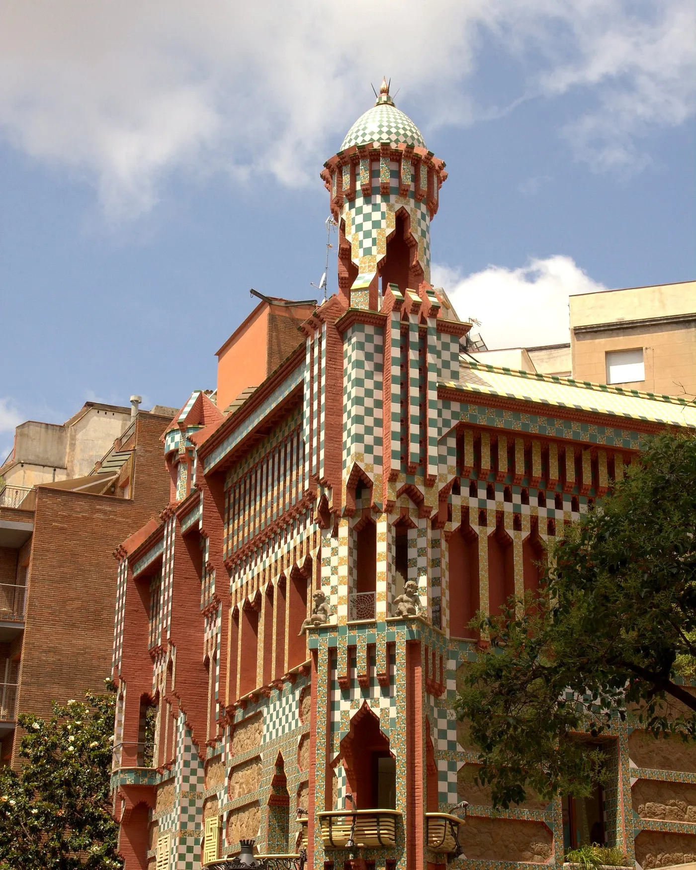
Casa Vicens is in la Vila de Gràcia. Its street is not — or not all of it. The register lists carrer de les Carolines as running through two districts, Gràcia and Sarrià-Sant Gervasi, and two neighbourhoods.
So the most-visited building in the old town stands on a street that leaves the district partway along. Whether the house is worth the ticket is a separate argument, made at length in is Casa Vicens worth it.
What to do with all this
If you are booking a room “in Gràcia”, check the barri, not the district. La Vila de Gràcia and el Camp d’en Grassot are flat-ish and walkable; the other three are a hill. That, with the trade-offs, is staying in Gràcia.
If somebody tells you a metro station is in Gràcia, check that too. Four of the ones routinely recommended are in other districts entirely — how to get to Gràcia lists which.
And if you are deciding whether any of this is your kind of afternoon, the honest version, including what the city’s visitor survey does and does not measure, is is Gràcia worth visiting.
The version with somebody keeping track
Our Gràcia walking tour stays inside la Vila de Gràcia, which is deliberate: it is the part that was the town, and the part where the story of the annexation is still legible in the buildings. Three hours, ten people, a working actor for a guide telling you who lived here when it belonged to somebody else, and a glass of vermouth at the end.
The boundaries are free to walk, though, and now you know where they run.
Where this comes from
- Unitats administratives de la ciutat de BarcelonaOpen Data BCN · Ajuntament de BarcelonaThe official list of barris under district 06, Gràcia, with their codes: 28 Vallcarca i els Penitents, 29 el Coll, 30 la Salut, 31 la Vila de Gràcia, 32 el Camp d'en Grassot i Gràcia Nova.
- Densitat de població de la ciutat de Barcelona (2021)Open Data BCN · Ajuntament de BarcelonaThe 2021 figures per barri used here: Vallcarca i els Penitents 16,142 residents on 125.1 ha; el Coll 7,590 on 35.3 ha; la Salut 13,282 on 64.8 ha; la Vila de Gràcia 49,492 on 132.1 ha; el Camp d'en Grassot i Gràcia Nova 34,932 on 65.1 ha. The dataset distinguishes gross density from net density, which counts residential area only.
- El districte i els seus barrisAjuntament de Barcelona · Districte de GràciaThe district's own figures, which do not match the open data and carry no reference year: 120.907 residents on 418,60 ha for the district, and for Vallcarca i els Penitents 15.448 residents on 120,90 ha against the 16,142 on 125.1 ha published in the 2021 density dataset.
- Coneixeu el districte — HistòriaAjuntament de Barcelona · Districte de GràciaThat the old core 'no ha deixat mai de reivindicar amb orgull el seu passat com a municipi independent (es va agregar a la ciutat el 1897)'; that Vallcarca adds the Penitents place-name 'per la vinculació històrica entre tots dos territoris'; and that 'per contra, el Coll guanya entitat pròpia com a barri i se separa de Vallcarca'.
- Gràcia (districte i antic municipi)Gran Enciclopèdia CatalanaThat the municipality of Gràcia was formed in 1850 with 13,548 inhabitants and re-annexed to Barcelona in 1897 with 61,935; that 'el 1984 fou creat el districte de Gràcia […] que a la major part del barri antic incorporà Vallcarca, el Coll i els Penitents, que pertanyien a Horta'; and that the south-western part of the old town, beyond Via Augusta, went to Sarrià-Sant Gervasi and to the Eixample.
- VallcarcaGran Enciclopèdia CatalanaThat Vallcarca's territory belonged to the old parish of Sant Genís dels Agudells and that in the nineteenth century it was 'un dels quatre districtes en què era dividit el terme municipal d'Horta', with 1,779 inhabitants in 1905, a third of Horta's population.
- Els PenitentsGran Enciclopèdia CatalanaThat 'el 1888 els Penitents constituïa un dels cinc districtes de l'antic municipi d'Horta' — five, where the entry on Vallcarca says four — and that the name comes from the Carmelite Francesc Palau, who from 1860 turned an estate into a convent for the sick and marginalised and promoted solitary penance in caves dug into the hillside; that Jacint Verdaguer bought the estate in 1892 and lived there; and that the convent was demolished by the council of Horta in 1895.
- Avinguda de VallcarcaAjuntament de Barcelona · Nomenclàtor de BarcelonaThat Vallcarca grew at the end of the nineteenth century as a summer neighbourhood for Barcelona's artisan class, kept its structure of villas and small industry until the 1950s, 'formava part del terme municipal d'Horta i de la parròquia de Sant Genís dels Agudells', and that 'vall carca' or 'càrquera' appears to be a Latin-Arabic hybrid meaning 'noisy valley'. The sentence giving the year it passed to the district of Gràcia is left unfinished in the register itself: 'només va passar a dependre del districte de Gràcia a partir de l'any ...'.
- Carrer dels PenitentsAjuntament de Barcelona · Nomenclàtor de BarcelonaThat the name comes from six hermits who settled there around 1860 led by Pare Palau, a preacher and publicist who around 1868 brought out a publication called El Ermitaño.
- Carrer de la Mare de Déu de la SalutAjuntament de Barcelona · Nomenclàtor de BarcelonaThat the chapel or sanctuary in a house on the site opened for worship in 1864 and gave its name to the neighbourhood, which began to be built around it between 1866 and 1870, and that the street was called simply de la Salut until 1949.
- Carrer de la Font del CollAjuntament de Barcelona · Nomenclàtor de BarcelonaThat this is the Font-rúbia, a place-name documented in 1099, near the sanctuary of el Coll.
- Parc GüellAjuntament de Barcelona · Nomenclàtor de BarcelonaThat the register files Park Güell under three barris at once — Vallcarca i els Penitents, el Coll and la Salut — and dedicates it to Eusebi Güell i Bacigalupi, 'promotor de la urbanització, a cura de l'arquitecte Gaudí, en una finca de la seva propietat'. The record's century field reads 'Segle XVIII', which is plainly an error in the data.
- Park Güell — el parcAjuntament de Barcelona · Park GüellThat 'el parc està situat al districte de Gràcia, entre els barris de La Salut, Vallcarca-Penitents i El Coll, i limita amb el del Carmel'.
- Carrer de les CarolinesAjuntament de Barcelona · Nomenclàtor de BarcelonaThat the street Casa Vicens stands on runs through two districts, Sarrià-Sant Gervasi and Gràcia, and two barris, el Putxet i el Farró and la Vila de Gràcia.
Everything above that carries a date, a figure or a name is checked against these before it is published. Where we could not find a source, the page says so.
Quick answers
- How many neighbourhoods are there in Gràcia?
- Five. The city's register of administrative units, under district 06, lists Vallcarca i els Penitents, el Coll, la Salut, la Vila de Gràcia and el Camp d'en Grassot i Gràcia Nova. The one visitors mean is la Vila de Gràcia, which is the old town.
- Is Park Güell in Gràcia?
- It is in the district, and it is in three of its neighbourhoods at once. The city's street register files the park under Vallcarca i els Penitents, el Coll and la Salut together, and the park's own site says it sits between those three. The district website's one-line description putting it in la Salut is a simplification.
- Was the whole district of Gràcia an independent town?
- No. Gràcia was an independent municipality from 1850 until it was annexed in 1897, but the modern district was drawn in 1984 and does not match it. Vallcarca, els Penitents and el Coll belonged to Horta, and a slice of the real old Gràcia — south-west of Via Augusta — was given to Sarrià-Sant Gervasi and the Eixample.
- Which neighbourhood of Gràcia should I actually walk around?
- La Vila de Gràcia. It is the densest, it holds the squares, the market and Casa Vicens, and it is where the street plan still shows a town that was laid out without a plan. The other four are residential and hilly, and one of them is mostly Park Güell.
- Is Casa Vicens in Gràcia?
- The building is, in la Vila de Gràcia. Its street is not, entirely: the city's register lists carrer de les Carolines as running through both Gràcia and Sarrià-Sant Gervasi. It is a good illustration of how arbitrary the edge is up there.
The tours this piece is about
More in the journal
Gràcia
- What to see in Gràcia, in the order that walks well
- Is Gràcia worth visiting? Half a day, and here is the measurement
- Chillida hung fifty-four tonnes of concrete over a quarry pool, and said the water made half of it
- Gràcia was its own town until 1897, and the street plan never forgave it
- April 1870: the bell of Gràcia cracked, and went on ringing
- Gràcia built a bell tower with no church attached, and put the signs of the zodiac on it to make the point