
Gràcia
Why the streets of Gràcia are like that: two roads, four streams and a convent
People look Gràcia up on a map and come away confused: no axis, no centre, nothing to orient off. The shape makes sense the moment you know it was drawn by water and by two roads, and by a different government from the one next door.
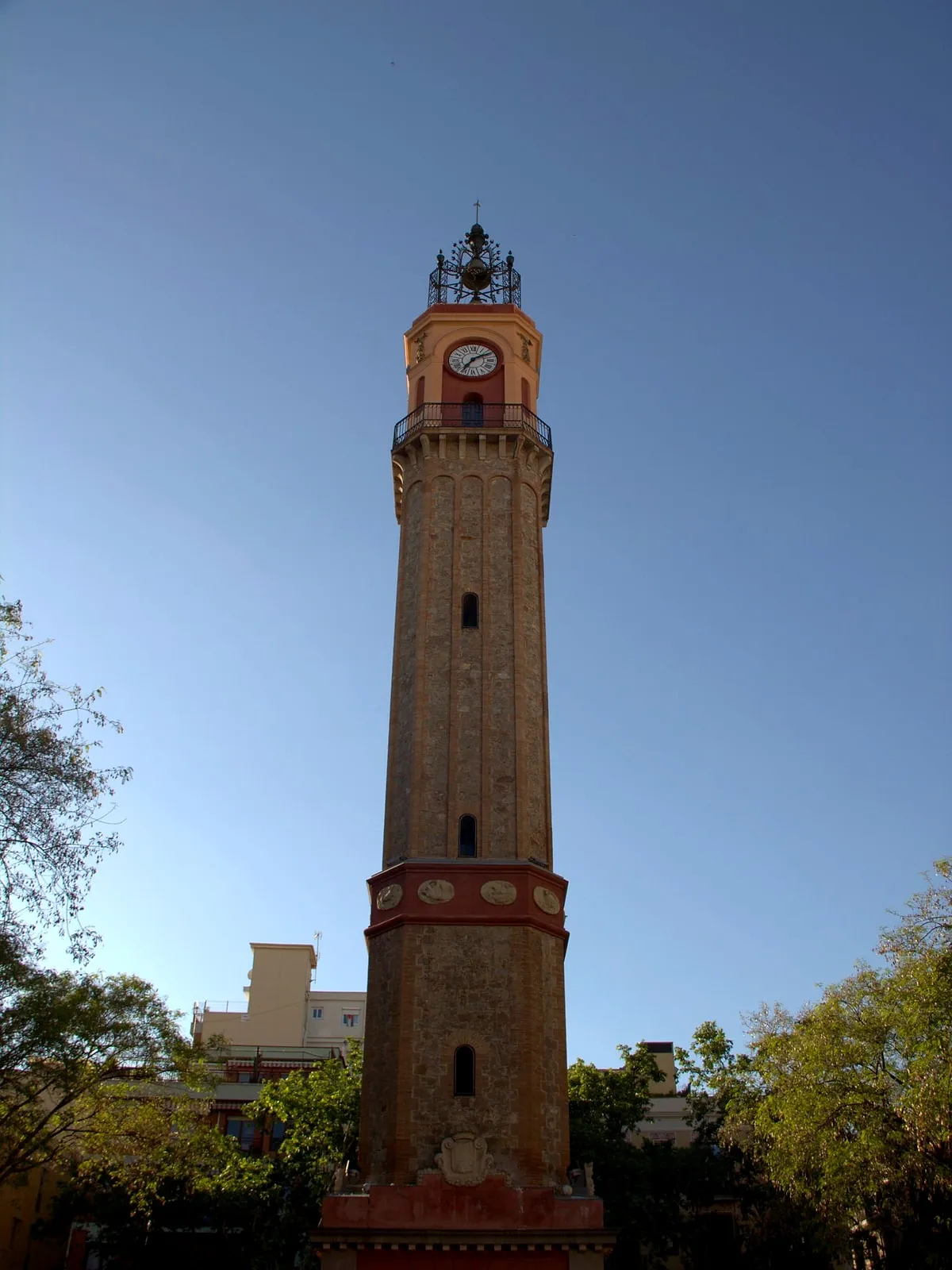
Everybody looks Gràcia up on a map before they come, and the map is useless. No axis to follow, no centre to aim at, no monument to orient off. It reads as a smudge of short streets with squares scattered through it at no particular interval.
That is not a failure of the map. It is an accurate picture of a place that nobody drew.
Barcelona happens to publish, street by street, why each of its streets is called what it is called and what was there before — and read in bulk for this neighbourhood, it explains almost the whole shape.
It starts with a convent
The town is named after a building that is no longer there.
The city’s register says Gràcia grew up around the Carmelite convent of Santa Maria — or Nostra Senyora — de Gràcia, founded in 1626, on what is now Plaça de Lesseps, and known to everybody as els Josepets. The square kept that name officially until 1895.
So the sequence is: a convent on the road out of Barcelona, then a village around the convent, then a town, then a district. Every subsequent thing in this neighbourhood is downstream of a religious house at what is now a traffic interchange.
Then two roads, and the water between them
This is the sentence that does most of the work, and it is the city’s, not ours:
the two streams formed one of the two axes of communication along which, and between which, Gràcia developed from the seventeenth century — the other being carrer Gran de Gràcia.
Axis one: carrer Gran de Gràcia. The register calls it simply the main street of the old town of Gràcia. Passeig de Gràcia is its continuation downhill, which is not a coincidence of naming: it is one line with two halves and two very different fates.
Axis two: the water. The rieres of Cassoles and Sant Miquel, running roughly parallel, one stream taking a different name in each stretch, which the city notes was completely normal. This is the older of the two: the register records that the Roman-date road from Barcelona to Sant Cugat ran here, following the stream up towards Collserola.
And here two municipal sources disagree about the main street
You will read everywhere that Gran de Gràcia is the old road to Sant Cugat. The encyclopedia says so, identifying that road with “l’actual passeig de Gràcia, prolongat pel carrer Gran de Gràcia”.
The district’s own study of the historic paths between Gràcia and Collserola says something else, and it is more specific. In its catalogue of twelve routes, the camí ral — also called the camí de Jesús — is path number one, and it climbed by way of carrer Príncep d’Astúries and the riera de Sant Miquel. Gran de Gràcia is path number four, and the study describes it like this:
The road running along today’s Gran de Gràcia begins to take shape from the building of the Josepets convent in the seventeenth century, as an alternative to the camí ral […] It is therefore one of the more modern alignments, even though it would end up being the main urbanising axis of the future neighbourhood, and the established link between Barcelona and Vallcarca.
Which, if the district is right, reverses the usual story rather neatly: the street did not create the convent’s neighbourhood, the convent created the street. And it makes Gran de Gràcia one of the newer things in Gràcia rather than the oldest.
We are not in a position to settle it. You are getting both.
Everything in between those two lines filled in over two centuries, at whatever width the plot happened to be. That is the whole planning history.
The streams are still there, under the street names
Read the register and Gràcia turns into a drainage map.
Carrer del Torrent de l’Olla is classified by the city not as a person or an event but as a geographical feature, and its entire entry is five words long: an old torrent that crossed the town of Gràcia.
Avinguda de la Riera de Cassoles follows the old course of the riera. The bed of that stream had been one of the roads over Collserola since antiquity, which is why it kept flooding in the autumn rains, which is why in the eighteenth century they cut the riera d’en Malla to divert the water westwards in heavy weather. Between 1850 and 1897 that same riera was the boundary between the municipality of Gràcia and the municipality of Sant Gervasi de Cassoles. A stream as a border between two towns that are both now Barcelona.
Carrer del Torrent d’en Vidalet is named for Can Vidalet, the farmhouse — so the stream took its name from the house rather than the other way round.
And the city’s definitions make the pattern explicit: a riera is registered as a space where there had been a riera; a torrent as a place where a torrent ran; a rambla as a promenade on what had been the bed of a riera or torrent. Barcelona names its streets after its own hydrology in the past tense.
The exception, which is the best thing on this page
Having established all that, here is the street that will catch you out.
Carrer del Torrent de les Flors is not named after a torrent. The city registers it under a person: Juan Manuel Torrente de Flores (Ferrol, 1829–1916), who emigrated to Cuba at fifteen, came back at twenty-eight, and ended up part-owner of the Alegre de Dalt estate. The entry records that he declined to put his surname alone on one of the streets of his development, in favour of a more popular name.
A property developer’s vanity, softened into something that sounds like geography, and it has been fooling people for a hundred and fifty years. Including, until we checked, us.
It also documents the mechanism nobody writes down: a large part of Gràcia was laid out by landowners subdividing their own estates, one at a time, with no coordination between them. That is exactly what the street plan looks like from above.
Go and stand on the line
The best thing in this article costs nothing.
Walk up Passeig de Gràcia to the top. At the Jardinets, the boulevard stops. Behind you: wide, straight, chamfered corners, the same block over and over — an engineer’s grid, designed from nothing. Ahead: narrow, slightly crooked, blocks of no consistent size, corners that are just corners.
Nothing marks it. No sign, no change in the paving. But you can feel the transition in your feet, and once you have felt it you cannot unsee it on a map either.
What the far side of that line was — a town with its own mayor, annexed by royal decree in 1897 — is why Gràcia was its own town.
One honest note on that date. The city contradicts itself about when the town began. The register entry for the Travessera says Gràcia was an independent municipality between 1718 and 1897; the entry for Plaça de la Vila de Gràcia says it obtained segregation from Barcelona in 1850, after earlier failed attempts. The encyclopedia says 1850 too. Everybody agrees on 1897. We use 1850 and we are telling you the other figure exists, rather than picking the one that reads better.
Squares, not passageways — and the register settles it
Gràcia is famous for two things architecturally: its squares and its covered passageways. Counting the city’s own register of named public spaces, only one of those reputations survives.
In the Vila de Gràcia there are twenty-one officially named squares and three named passatges. The passatges of this district are mostly somewhere else — up in Gràcia Nova and in Vallcarca, laid out later.
So: a neighbourhood of squares. Small, frequent, shaped by whatever was around them when they stopped being built on, and still in use for different things at different hours. Square by square, that is here.
What the shape does to you as a walker
You cannot see far. No sightlines, so no orientation by landmark, so you will get mildly lost. This is the intended experience; there is nothing to miss.
Everything arrives suddenly. Squares appear at the end of streets with no approach, which is why a small square here lands harder than a large one elsewhere.
It is uphill. Gràcia sits above the Eixample and the whole thing tilts. Walk it downhill if you have the choice.
Distances are shorter than they feel. About three kilometres end to end, which is nothing, but the density of turns makes it feel like more.
What is left from before the streets
The clearest physical evidence that this was a factory town rather than a suburb is a single brick chimney standing among the flats with nothing attached to it. How many there are — and how many we had wrongly claimed there were — is in the chimneys of Gràcia. The other survivor of those decades is still working: the covered market the town built for itself in 1888.
Using this while you are actually there
- Do not navigate by map. Navigate by squares. Get to one, sit down, aim at the next.
- Start at the top and walk down if you are coming in from the Eixample.
- Accept the getting lost. It takes ten minutes to walk out of Gràcia in any direction.
The route that manages the turns for you, without repeating a street, is what to see in Gràcia; the hour to do it at is a day in Gràcia; and the practical business of arriving is how to get to Gràcia.
Or have it pointed out
Our Gràcia walking tour starts at the Jardinets — on the line, deliberately — and walks up through the streets telling what happened on them when they belonged to a different town. The guide is a working actor, which shows in the telling rather than in any costume. Three hours, ten people, and a glass of vermouth at the end.
The line under your feet is free, though, and it is there whether or not anybody is talking.
And the other half of the register’s evidence, which is where the covered lanes people come looking for actually are: thirty passatges in the district and three in Gràcia. The district-versus-town confusion behind that is here.
Where this comes from
- Camins històrics de Gràcia a Collserola (2022) — fitxa 4, Camí Gran de GràciaAjuntament de Barcelona · Districte de GràciaThat the road along today's Gran de Gràcia 'es comença a configurar a partir de la construcció del convent dels Josepets al segle XVII, com una alternativa al camí ral que pujava seguint l'actual carrer príncep d'Astúries i riera de Sant Miquel', that it is 'un dels traçats més moderns', and that it became the main urbanising axis of the neighbourhood and the link between Barcelona and Vallcarca. Note that the encyclopedia instead identifies the Barcelona-Sant Cugat road with Passeig de Gràcia prolonged by Gran de Gràcia.
- Camins històrics de Gràcia a Collserola (2022) — fitxa 1, Camí Ral - de JesúsAjuntament de Barcelona · Districte de GràciaThat the first stretch of the old royal road from Barcelona towards Sant Cugat was also called the camí de Jesús, after the convent of Santa Maria de Jesús it left the city beside, and that it followed the alignment of Passeig de Gràcia before bearing off into carrer riera de Sant Miquel and then carrer Príncep d'Astúries up to today's Plaça de Lesseps.
- Travessera de GràciaAjuntament de Barcelona · Nomenclàtor de BarcelonaThat Gràcia takes its name from the convent of Nostra Senyora de Gràcia, 'fundat el 1626 a l'actual plaça de Lesseps i conegut popularment amb el nom dels Josepets'. Note that this entry dates the independent municipality from 1718, while the entry for Plaça de la Vila de Gràcia dates the segregation from Barcelona to 1850; both agree on 1897 for the annexation.
- Plaça de LessepsAjuntament de Barcelona · Nomenclàtor de BarcelonaThat the site was popularly known as Josepets after the Carmelite convent of Santa Maria de Gràcia founded in 1626, and that the square carried the name Josepets officially until 1895.
- Carrer de la Riera de Sant MiquelAjuntament de Barcelona · Nomenclàtor de BarcelonaThat this was part of the Roman-era road from Barcelona to Sant Cugat which continued towards Collserola following the course of the riera de Cassoles, and that 'les dues rieres van formar un dels dos eixos de comunicació al llarg dels quals, i entre els quals, es va desenvolupar Gràcia a partir del segle XVII', the other axis being carrer Gran de Gràcia.
- Avinguda de la Riera de CassolesAjuntament de Barcelona · Nomenclàtor de BarcelonaThat the avenue follows the old course of the riera; that the stream bed had been one of the roads over Collserola since antiquity and flooded in the autumn rains, which is why the riera d'en Malla was cut in the eighteenth century to divert the water; and that the riera de Cassoles was the boundary between the municipalities of Gràcia and Sant Gervasi de Cassoles between 1850 and 1897.
- Carrer del Torrent de l'OllaAjuntament de Barcelona · Nomenclàtor de BarcelonaThat the street is registered as a geographical feature: 'Antic torrent que travessava la vila de Gràcia'.
- Carrer del Torrent de les FlorsAjuntament de Barcelona · Nomenclàtor de BarcelonaThat this street is registered not as a watercourse but under a person: Juan Manuel Torrente de Flores (Ferrol, 1829-1916), part-owner of the Alegre de Dalt estate, who declined to put his surname alone on a street of his development and used the more popular form instead.
- Tipologia de viesAjuntament de Barcelona · Nomenclàtor de BarcelonaThe city's own definitions of plaça, passatge, riera, torrent and rambla — a riera being 'espai on hi havia hagut una riera', a torrent 'lloc per on discorria un torrent', a rambla 'passeig sobre el que havia estat el llit d'una riera o torrent'.
- Nomenclàtor de Barcelona (dataset of street names)Open Data BCN · Ajuntament de BarcelonaThe published register of the city's 4,647 named public spaces, from which the count of twenty-one squares and three passatges in the Vila de Gràcia is taken.
Everything above that carries a date, a figure or a name is checked against these before it is published. Where we could not find a source, the page says so.
Quick answers
- Why are the streets in Gràcia so narrow?
- Because the place grew along two existing roads rather than to a plan. The city's street register says Gràcia developed from the seventeenth century along and between two axes: the Roman-era road from Barcelona to Sant Cugat, which is today's carrer Gran de Gràcia, and the line of the rieres of Cassoles and Sant Miquel. Barcelona's grid next door was designed from scratch by an engineer. Gràcia's was not designed at all.
- Where does the name Gràcia come from?
- From a convent. Two entries in the city's street register agree that the town grew up around the Carmelite convent of Santa Maria — or Nostra Senyora — de Gràcia, founded in 1626 where Plaça de Lesseps is now and known locally as els Josepets. The square itself was officially called Josepets until 1895.
- Did the streets of Gràcia follow streams?
- Several did, and the city says so street by street. Carrer del Torrent de l'Olla is registered as 'an old torrent that crossed the town of Gràcia'; the avinguda de la Riera de Cassoles 'follows the old course of the riera'. But not all of them: carrer del Torrent de les Flors is named after a landowner called Torrente, not after any watercourse.
- Where does Gràcia start and end?
- It starts where Passeig de Gràcia stops, at the Jardinets, and runs uphill. The clearest boundary is underfoot: the moment the chamfered corners of the Eixample stop, you are in it.
- How many squares does Gràcia have?
- Counting the city's own register of street names, the Vila de Gràcia has twenty-one officially named squares — against three named passatges. That ratio is the neighbourhood in one line: it is a place of squares, and the covered passageways people associate with Gràcia are mostly in Gràcia Nova and Vallcarca, further up.
The tours this piece is about
More in the journal
Gràcia
- Shopping in Gràcia: the street and the neighbourhood are not the same place
- Gràcia has thirty passatges and only three of them are in Gràcia
- The man who built modernista Gràcia was not allowed to sign it, and the city's catalogue names who did
- Gràcia has a Liberty street and a Fraternity street, and the jewels are a silversmith's sales pitch
- Mercat de la Llibertat: the iron hall a town built for itself, nine years before it stopped being a town
- The Abaceria: a market that has been in a marquee since 2019, and the cotton mill they found underneath it