
Montjuïc
Barcelona had no natural harbour, so it spent five hundred years building one
The hill you climb for the view is the reason the harbour below it exists — and the harbour is entirely artificial, on ground that was sea.
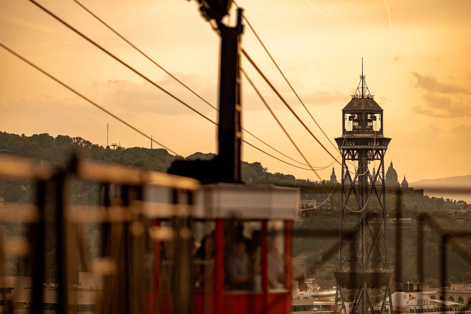
Stand at the top of Montjuïc, look down at the port, and you are looking at a piece of engineering, not a piece of coast. Almost everything in the frame — the moles, the basins, the container terminals, the ground under the Barceloneta — was made.
The Port de Barcelona says why in its first paragraph, and it is unusually frank for an institution describing its own reason to exist:
Since it had no natural maritime shelter, the dynamic of the coast brought about a constant intake of sand, and there was not enough safety and depth to allow ships to come in.
That is the whole problem in one sentence. A river-fed, sand-moving coastline with no headland and no bay. Barcelona is a great maritime city built at a place that is bad at being a port.
The shelter was round the corner, and nobody built the city there
The best detail in the Port’s history is the one about who used the coast before Barcelona did:
The Iberians and other pre-Roman peoples used the natural bay south of Montjuïc for maritime exchanges.
There was shelter. It was on the far side of the hill. The Romans moved the activity to the beaches of Bàrcino, where the imports from Rome arrived, and the city grew there — inland of a beach, not around a harbour.
So Montjuïc is not a scenic backdrop to the port. It is the piece of geography that made the port both necessary and possible: it blocked the good anchorage and it supplied the stone that built the city, and later the height for the landfall light.
Five hundred years of losing to sand
The chronology is a slow, unglamorous grind and that is the point.
By the end of the fourteenth century the city had the royal shipyards and had tried other harbour works. But —
it was not until 1477 that the first works to achieve a safe port began.
And those works were done in what would later be the seafaring district of the Barceloneta. They were the beginnings of the artificial port, built on land won from the sea. The neighbourhood came two hundred and seventy-six years later, on ground that these works had trapped.
The Port’s own summary of the following centuries: the advances were slow and laborious, and the sand went on causing problems. By 1772 the mole reached what is now the moll de Pescadors, where the port’s first lighthouse was built — the building we now call the Clock Tower.
Then the twentieth century, at a completely different speed
- 1965-1966 — the plans that made it possible to double the port surface in less than fifteen years.
- 1978 — the ministry grants port autonomy; the Port Autònom stays public but runs as a commercial company.
- 1992 — the Olympics. The port takes in more than ten cruise ships to make up for the city’s lack of hotel places. Worth remembering the next time anybody describes cruise traffic here as a recent imposition: Barcelona used cruise ships as overflow hotels for its own showcase year.
- 1989 — the master plan set the bases for the port’s expansion: it envisaged diverting the river Llobregat two kilometres to the south, which would double the surface again, and created the ZAL logistics zone.
- 2008 — the southern and eastern breakwaters, the highest investment in the port’s history (501 million euros), with 53 % coming from the European Cohesion Fund. The expansion made it necessary to open the Bocana Nord.
⚠️ A precision worth keeping. The Port documents the 1989 plan to move the Llobregat. It does not, on that page, give the year the diversion was executed. We date the plan. If you see a confident year for the river actually moving, it did not come from here.
Half a billion euros of breakwater, and more than half of it European. That is the scale at which a city with no natural harbour keeps one.
The port cannot agree with itself about its own size
Two pages, one institution.
The front page of Coneix el Port:
The Port of Barcelona has a surface of more than 1,100 hectares.
The Territori Port page inside the same section:
With more than 1,000 hectares of land surface and 23 km of quay, the Port of Barcelona is a highly diversified port hosting some thirty specialised terminals.
A hundred hectares apart. The obvious reconciliation is total area against land area — water counts in one and not the other — and it is very likely right. But neither page says so, and a reconciliation we invented is not a source.
So when we quote a figure we quote the qualified one: over a thousand hectares of land surface, with 23 km of quay and around thirty specialised terminals. If a number does not say what it measures, it is not a number yet.
We keep finding this. The city could not agree on the area of Gràcia either, and we have already had to retract a hectare figure for Montjuïc itself.
What this changes about the view
The harbour is the machine, not the scenery. The container cranes are the economically serious part of the picture. The pretty part — the Port Vell, the marina, the wooden footbridge — is the bit the port gave back to the city in the 1980s and 1990s.
The shape of the coastline is a decision. Every line you can see was drawn: the moles, the entrances, the reclaimed platforms. The one natural thing in the view is the hill you are standing on.
And the two are being reconnected. The 2025 protocol between the city and the Port includes an urban corridor along the Montjuïc seafront linking plaça de les Drassanes with the Marina del Prat Vermell and the Zona Franca — public transport, taxis, bikes and pedestrians round the seaward foot of the mountain. Whatever else it does, it puts the hill and the harbour back on speaking terms.
Where to see it from
The Mirador de l’Alcalde, on the seaward flank, which looks straight down at the working port and has the strangest floor in Barcelona.
The castle, higher up, where you get the whole sweep including the Bocana Nord and the breakwaters — and where you should know what the fortress was actually for.
The Costa i Llobera gardens, low down near the port cable-car station, which are at ship’s-eye level and among the best gardens on the hill.
Our Montjuïc walk runs Tuesday and Thursday afternoons. We are closed on 25 December and 1 January.
Where this comes from
- Coneix el Port — HistòriaPort de BarcelonaThat «com que no tenia resguards marítims naturals, la dinàmica del litoral comportava l'entrada constant de sorra i no hi havia prou seguretat i calat per propiciar l'accés de vaixells»; that «els ibers i altres pobles preromans van fer servir la badia natural al sud de Montjuïc per als intercanvis marítims» and the Romans moved that activity to the beaches of Bàrcino; that the royal shipyards existed by the end of the fourteenth century but that «no va ser fins al 1477 que van començar les primeres obres per aconseguir un port segur», carried out «en el que més endavant seria el barri mariner de la Barceloneta»; that by 1772 the mole reached the present moll de Pescadors, where the first lighthouse was built, today the Torre del Rellotge; that the 1965-1966 plans «van permetre duplicar la superfície portuària en menys de 15 anys»; that in 1978 the ministry granted the port its autonomy; that in 1992 the port took in more than ten cruise ships «per suplir la manca de places hoteleres de la ciutat»; that «el Pla director 1989 va fixar les bases per a l'ampliació portuària: preveia desviar el riu Llobregat dos quilòmetres cap al sud», doubling the surface again and creating the ZAL; and that in 2008 the southern and eastern breakwaters were completed, «la inversió més alta de la història del port (501 milions d'euros), amb un 53% procedent del Fons de Cohesió Europeu», the expansion having made it necessary to open the Bocana Nord.
- Coneix el PortPort de BarcelonaThat «el Port de Barcelona té una superfície de més de 1.100 hectàrees, on conviuen nombroses activitats, instal·lacions i serveis».
- Territori PortPort de BarcelonaThat «amb més de 1.000 hectàrees de superfície terrestre i 23 km de moll, el Port de Barcelona és un port altament diversificat que acull una trentena de terminals especialitzades» — a different figure, qualified as land surface, from the one on the section's own front page.
Everything above that carries a date, a figure or a name is checked against these before it is published. Where we could not find a source, the page says so.
Quick answers
- Does Barcelona have a natural harbour?
- No, and the Port says so itself: «com que no tenia resguards marítims naturals, la dinàmica del litoral comportava l'entrada constant de sorra i no hi havia prou seguretat i calat per propiciar l'accés de vaixells». Everything in front of Montjuïc is built.
- Where did ships put in before there was a port?
- On the other side of the hill. The Port's history says «els ibers i altres pobles preromans van fer servir la badia natural al sud de Montjuïc per als intercanvis marítims», and that the Romans moved the activity to the beaches of Bàrcino. The natural shelter Barcelona did not have was round the corner from where Barcelona was founded.
- When did work on the port start?
- 1477, on the Port's own account, after earlier attempts. It says the works were carried out «en el que més endavant seria el barri mariner de la Barceloneta. Van ser els inicis del port artificial, construït en terrenys guanyats al mar».
- How big is the port of Barcelona?
- The Port publishes two different figures on two of its own pages. One says «el Port de Barcelona té una superfície de més de 1.100 hectàrees»; another says «amb més de 1.000 hectàrees de superfície terrestre i 23 km de moll». The two can probably be reconciled as total area against land area, but neither page says so, so we quote the qualified one: over 1,000 hectares of land surface.
- What was the biggest single investment in the port's history?
- The southern and eastern breakwaters, finished in 2008. The Port calls them «la inversió més alta de la història del port (501 milions d'euros), amb un 53% procedent del Fons de Cohesió Europeu». The expansion also made it necessary to open the Bocana Nord.
- Did the port really plan to move a river?
- Yes. The 1989 master plan «preveia desviar el riu Llobregat dos quilòmetres cap al sud», which would have doubled the port's surface again. Note that the Port documents the plan, not the year the diversion was carried out — so we date the plan and not the execution.
- Why is the port relevant to a walk on Montjuïc?
- Because the hill is the port's balcony and its quarry. The stone the old city is built from came out of this hill, the landfall lighthouse sits on it because height is range, and the 2025 protocol between the city and the Port includes an urban corridor along the Montjuïc seafront linking plaça de les Drassanes to the Marina del Prat Vermell and the Zona Franca.
The tours this piece is about
More in the journal
Montjuïc
- Formula One raced through this park four times, and no institution in Barcelona records how it stopped
- The Magic Fountain was switched off for two and a half years, and the city's own spec sheet still describes a machine that no longer exists
- The most influential building in Barcelona stood for about a year, and the one you can visit is legally a new building
- A modernista cotton mill that spent longer as a police barracks than as a factory
- They put a lighthouse on the mountain because the old one was at sea level
- Barcelona is knocking down three cruise terminals, and the mayor called it the first limit in history